Showing 238 items matching department of lands and survey
-
 Marysville & District Historical Society
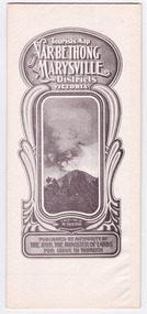
Map (Item) - Tourist Map, Department of Lands & Survey, Tourist's Map of Narbethong and Marysville Districts Victoria, 1913
... department of lands & survey... that was originally produced by the Department of Lands & Survey in 1925.... that was originally produced by the Department of Lands & Survey in 1925...., Government Printer, Melbourne. Photo Lithographed at the Department...Department of Lands & Survey... that was originally produced by the Department of Lands & Survey in 1925 ...A tourist map for the Narbethong and Marysville Districts that was originally produced by the Department of Lands & Survey in 1925.A tourist map for the Narbethong and Marysville Districts that was originally produced by the Department of Lands & Survey in 1925.Reprint of the 1925 Tourist brochure by permission R.E. Holmes Surveyor General By Authority: ALBERT J. MULLETT, Government Printer, Melbourne. Photo Lithographed at the Department of Lands and Survey Melbourne by W.J. Butson/ 26.8.13narbethong, marysville, victoria, department of lands & survey, the acheron valley, warburton, map, tourist map -
 Marysville & District Historical Society
Map (Item) - Tourist Map, Department of Lands & Survey, Tourist's Map of Narbethong and Marysville Districts Victoria, 1913
... department of lands & survey... that was originally produced by the Department of Lands & Survey in 1925.... that was originally produced by the Department of Lands & Survey in 1925...., Government Printer, Melbourne. Photo Lithographed at the Department...Department of Lands & Survey... that was originally produced by the Department of Lands & Survey in 1925 ...A tourist map for the Narbethong and Marysville Districts that was originally produced by the Department of Lands & Survey in 1925.A tourist map for the Narbethong and Marysville Districts that was originally produced by the Department of Lands & Survey in 1925.Reprint of the 1925 Tourist brochure by permission R.E. Holmes Surveyor General By Authority: ALBERT J. MULLETT, Government Printer, Melbourne. Photo Lithographed at the Department of Lands and Survey Melbourne by W.J. Butson/ 26.8.13narbethong, marysville, victoria, department of lands & survey, the acheron valley, warburton, map, tourist map -
 Rutherglen Historical Society
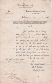
Document - License to thin trees, 1899 (Exact)
... "Department of Lands and Survey. On Forest Business"...Secretary for Lands, Department of Lands and Survey / On... 1890 "Department of Lands and Survey. On Forest Business" Dated ...Dated July 14th 1899. Sent to Mr W. Cooper / c/o Mr Barrie / Storekeeper / No. 2 Valley / Chiltern / "Copy of Land Act 1896 / Regulations. Chapter XI Thinning Licenses"Document on stiff paper. Letter to Mr W. Cooper granting license to thin trees on a block of land at Chiltern Reserve. On back, copy of Land Act Regulations 1890"Department of Lands and Survey. On Forest Business"license, timber felling, cooper family, forestry, chiltern reserve -
 Stawell Historical Society Inc
Map - Parish Map, Department of Lands and Survey, Ashens County of Borung 1941, 1941
... Drawn and Reproduced at the department of Lands and Survey...Department of Lands and Survey... Coloured Map Drawn and Reproduced at the department of Lands ...Murtoa Lake MarmaPaper Brown Coloured MapDrawn and Reproduced at the department of Lands and Survey Melbourne 1.5.1941survey -
Stawell Historical Society Inc
Map, Department of Lands & Survey J. Noone, Township of Heatherlie. Parish of Baroka. County of Borung 1888, 1888
... photo Lithographed at the Department of lands and Survey...Department of Lands & Survey J. Noone... photo Lithographed at the Department of lands and Survey ...Stawell & Grampians Freestone Quarry Company Railway Reserve. Cross & masons Quarry Site. Mamnager'sHouse, Stead's boarding House Stawell and Grampians railwaySurveyed Township Showing Quarry and railway Reservephoto Lithographed at the Department of lands and Survey Melbourne By J Noone 15.6.88railway quarry -
Stawell Historical Society Inc
Map, Department of Lands and Survey, Borough of Stawell. Parishes of Stawell and Illawarra 1903, 1903
... Photo Lithograped at the Department of Lands and survey...Department of Lands and Survey... on Paper Photo Lithograped at the Department of Lands and survey ...Victoria Co., St Georges Co., Wimerra Co., Leviathon Co. Tramway, Quarry reserve, Newington Co., Galatea Co., Moonlight Co., Federal Co., Borough reservior., A0 Map of Stawell on linen backing. Plus one Printed on PaperPhoto Lithograped at the Department of Lands and survey Melbourne by T.F. McGauran 13.6.03surevy -
 City of Moorabbin Historical Society (Operating the Box Cottage Museum)
Photograph - Map of Dendy's Special Survey, 1852 Map of Henry Dendy's Special Survey of 1841, 19th Century
... at the department of Lands and Survey. /Melbourne. / Price 1/- ...Department of Lands and Survey, Melbourne....-Lithographed at the department of Lands and Survey. /Melbourne. / Price ...A Map drawn in 1852 that shows the 5,120 acres that formed Dendy's Special Survey of 1841. In 1840 Henry Dendy, a farmer in Surrey, England acquired a "Special Survey" from the Commissioners for Land and Emigration which gave Dendy the right to choose land in Port Phillip for the "bargain basement" price of only £1 per acre for 5120 acres, (an area of 8 square miles). The Special Survey also included the right to "the shipment of a worker for every £20 spent on land, whose free passage was paid by the Crown, equalling a total of 100 workers ". Accordingly Dendy sold his English holdings and paid the required £5120 and arrived in Melbourne in February 1841. However by this time land in the new colony was selling for £5 - £40 per acre. Because Henry Dendy possessed the order from the Colonial Office in London he was able to successfully oppose Governor LaTrobe's attempts to alter the price of the land. Dendy appointed Jonathan Were, (an entrepreneur, who had arrived in 1839), as his Manager and who later became a partner. Together, Dendy and Were decided on an area 5 miles south from Melbourne, bounded by North Road, East Boundary Road, South Road and to the west by Port Phillip Bay. Were and Dendy pitched their tents in the area now known as ' Park St, Brighton' and sank a well near the corner of 'St Andrew's St and Wells St'. By 1845 J.B Were and Company had bought almost half of Dendy's land and Were built himself "Moorabbin House" in Were St Brighton made from stone, quarried from local cliffs. It was still standing in 1924. Legend records Moorabbin is named after the Aboriginal word for ' Mother's Milk ' The soil is very fertile and well supplied with water especially in the area called 'East Brighton' - now known as Bentleigh and East Bentleigh - By 1850 the area had developed with numerous market gardens, dairy farms, fruit gardens and vineyards supplying food for the growing population of Melbourne.This Map shows the birth of the Brighton and Moorabbin area. On 18th January1859 Brighton was proclaimed a Municipality and a Borough by October 1863. Meanwhile, following a Petition, the area of East and South Brighton, incorporating Mordialloc, Cheltenham, Mentone, Sandringham and Oakleigh separated from Brighton to form the Moorabbin District Roads Board becoming the first Local Government Authority. Col. William Mair was elected as the first Chairman of the Moorabbin Roads Board. Moorabbin Shire 1871 developed further and was declared a City in1934. The City of Moorabbin was the largest Municipality in Melbourne before the Amalgamation of Councils in 1994 when it was divided in the south to City of Kingston and in the north to City of Glen Eira A Photo-lithographed 1852 Map showing the 5,120 acres that formed Dendy's Special Survey of 1841. Henry Dendy & Jonathan Were chose an area 5 miles south from Melbourne, bounded by North Road, East Boundary Road, South Road and to the west by Port Phillip Bay. Moorabbin County of Bourke / Photo-Lithographed at the department of Lands and Survey. /Melbourne. / Price 1/- brighton, moorabbin, bentleigh, cheltenham, dendy henry, bent thomas, were jonathan, special survey -
Port Melbourne Historical & Preservation Society
Plan, Department of Lands and Survey, The Township of Sandridge, 25 Nov 1860
... at the department of Lands and Survey, Melbourne 5th November, 1860...Department of Lands and Survey... at the department of Lands and Survey, Melbourne 5th November, 1860 ...Plan of the township of Sandridge lithographed at the department of Lands and Survey, Melbourne 5th November, 1860. Identical to 1859 version except for added rail line through Sandridge and onto Town Pierengineering - roads streets lanes and footpaths, municipal district of sandridge -
Port Melbourne Historical & Preservation Society
Plan - Sandridge, Department of Lands and Survey, "The Township of Sandridge", 5 Nov 1860
... Lihographed at the Department of lands and Survey, Melbourne 5th...Department of Lands and Survey... Lihographed at the Department of lands and Survey, Melbourne 5th ...Map of Sandridge, lithographed 1860, showing subdivisions on Evans Street, but no other development West of the railway Lihographed at the Department of lands and Survey, Melbourne 5th November 1860. Hand drawn annotations added at unknown date.Hand written "clay ground" 18 chains long, 7.5 chains broad, 26 chains from railwayengineering - roads streets lanes and footpaths, sandridge lagoon, transport - railways, town planning, local government - borough of sandridge -
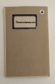
 Whittlesea Historical Society Inc.
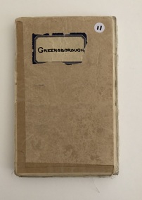
Map, Department of Crown Lands and Survey, Greensborough, County of Evelyn, 1961
... Drawn and reproduced at the Department of Lands and Survey...Department of Crown Lands and Survey... and reproduced at the Department of Lands and Survey, Melbourne. 1961 ...1 map, folding, showing parish boundaries and land ownership.Drawn and reproduced at the Department of Lands and Survey, Melbourne. 1961.map, greensborough, county of evelyn, greensborough parish map -
 Whittlesea Historical Society Inc.
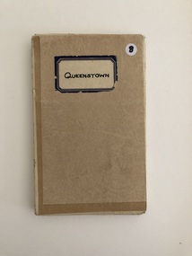
Map, Department of Crown Lands and Survey, Queenstown, County of Evelyn, 1961
... Drawn and reproduced at the Department of Lands and Survey...Department of Crown Lands and Survey... at the Department of Lands and Survey, Melbourne. 1961. map queenstown ...1 map, folding, showing parish boundaries and land ownership. Drawn and reproduced at the Department of Lands and Survey, Melbourne. 1961. map, queenstown, queenstown parish, county of evelyn -
 Whittlesea Historical Society Inc.
Map, Department of Crown Lands and Survey, Greensborough, County of Evelyn, 1961
... Drawn and reproduced at the Department of Lands and Survey...Department of Crown Lands and Survey... and reproduced at the Department of Lands and Survey, Melbourne. 1961 ...1 map, folding, showing parish boundaries and land ownership.Drawn and reproduced at the Department of Lands and Survey, Melbourne. 1961.map, greensborough parish map, county of evelyn -
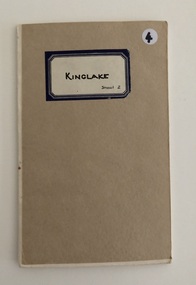 Whittlesea Historical Society Inc.
Map, Department of Crown Lands and Survey, Kinglake Sheet 2, 1961
... Drawn and reproduced at the Department of Lands and Survey...Department of Crown Lands and Survey... at the Department of Lands and Survey, Melbourne. 1959. map kinglake ...1 map, folding, showing parish boundaries and land ownership.Drawn and reproduced at the Department of Lands and Survey, Melbourne. 1959.map, kinglake, kinglake sheet 2, kinglake parish map -
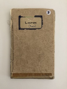 Whittlesea Historical Society Inc.
Map, Department of Crown Lands and Survey, Linton (North), County of Evelyn, 1944
... Drawn and reproduced at the Department of Lands and Survey...Department of Crown Lands and Survey... and reproduced at the Department of Lands and Survey, Melbourne. 22.1.44 ...1 map, folding, showing parish boundaries and land ownership.Drawn and reproduced at the Department of Lands and Survey, Melbourne. 22.1.44.map, linton north, linton parish map, county of evelyn -
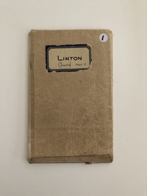 Whittlesea Historical Society Inc.
Map, Department of Crown Lands and Survey, Linton (South) Sheet 2, 1944
... Drawn and reproduced at the Department of Lands and Survey...Department of Crown Lands and Survey... at the Department of Lands and Survey, Melbourne. 22.1.44. map linton south ...1 map, folding, showing parish boundaries and land ownership.Drawn and reproduced at the Department of Lands and Survey, Melbourne. 22.1.44.map, linton south sheet 2, linton parish map, parish map -
Whitehorse Historical Society Inc.
Document, Department of Crown Lands and Survey, 1983
... Department of Crown Lands and Survey...Research guide of historical resources of the Department... Mitcham melbourne Document Document Department of Crown Lands ...Research guide of historical resources of the Department of Crown Lands and Survey. Compiled by P. Cabena, Aug 1983Research guide of historical resources of the Department of Crown Lands and Survey. Compiled by P. Cabena, Aug 1983Research guide of historical resources of the Department of Crown Lands and Survey. Compiled by P. Cabena, Aug 1983crown land, land surveys, victorian government -
 Whittlesea Historical Society Inc.
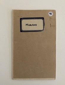
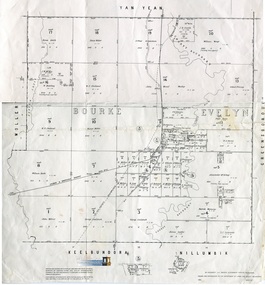
Map, Department of Crown Lands and Survey, Morang, Counties of Bourke & Evelyn, 1878
... Photo-lithographed at the Department of Lands and Survey...Department of Crown Lands and Survey...-lithographed at the Department of Lands and Survey, Melbourne by J ...1 map, folding, showing parish boundaries and land ownership.Photo-lithographed at the Department of Lands and Survey, Melbourne by J. Noone. 26.8.78map, morang, counties of bourke & evelyn, morang parish -
 Whittlesea Historical Society Inc.
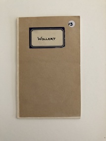
Map, Department of Crown Lands and Survey, Wollert, County of Bourke, 1963
... Photo - lithographed at the Department of Lands and Survey...Department of Crown Lands and Survey... at the Department of Lands and Survey Melbourne by J. Noone. 19.8.78 ...Coonan's Estate1 map, folding, showing parish boundaries and land ownership.Photo - lithographed at the Department of Lands and Survey Melbourne by J. Noone. 19.8.78map, wollert, county of bourke, wollert parish, coonan's estate -
 Whittlesea Historical Society Inc.
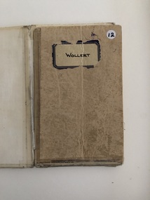
Map, Department of Crown Lands and Survey, Wollert, County of Bourke, c. 1963
... Photo - lithographed at the Department of Lands and Survey...Department of Crown Lands and Survey... at the Department of Lands and Survey, Melbourne by J. Noone. 19.8.78 map ...1 map, folding, showing parish boundaries and land ownership.Photo - lithographed at the Department of Lands and Survey, Melbourne by J. Noone. 19.8.78map, wollert, wollert parish map, county of bourke -
 Whittlesea Historical Society Inc.
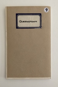
Map, Department of Crown Lands and Survey, Queenstown, County of Evelyn, 1961
... Drawn and produced at the Department of Lands and Survey...Department of Crown Lands and Survey... at the Department of Lands and Survey, Melbourne. 1961. Price 2/- map ...1 map, folding, showing parish boundaries and land ownership.Drawn and produced at the Department of Lands and Survey, Melbourne. 1961. Price 2/-map, queenstown, queenstown parish, county of evelyn -
 Whittlesea Historical Society Inc.
Map, Department of Crown Lands and Survey, Morang, Counties of Bourke & Evelyn, 1965
... Drawn and reproduced at the Department of Lands and Survey...Department of Crown Lands and Survey... railway Department of Crown Lands and Survey ...1 sheet, folded in half, Map, shows Portions 1 - 20, sizes of the blocks, and names of landowners.Drawn and reproduced at the Department of Lands and Survey, Melbourne. 1965. Price 10/-map, morang map, morang, counties of bourke and evelyn, fitzroy and whittlesea railway -
 Ballan Shire Historical Society
Map - Map. Bungal, Department of Lands and Survey, Bungal, County of Grant, 09/09/1926
... and the number L.358. Lithographed at the Department of Lands and Survey...Department of Lands and Survey..... Lithographed at the Department of Lands and Survey. Melbourne by W. J ...A map of Bungal in the 1920's showing the allotments, and the size, with the names of the residents. It shows the roads and the Western and Eastern Moorarbool River, and the Whipstick State Forest.Cream coloured map of Bungal in the County of Grant, bounded by the the East Moorarbool River on the East, and the State Forest on the South. It is marked with the scale of chains and the number L.358. Lithographed at the Department of Lands and Survey. Melbourne by W. J. Butson on 9.9.1926. It shows the land allotments with names of owners.Coloured pen marks and circled numbers on various areas. Price 2 shillings marked on bottom right hand edge.bungal, kerrit bareet, egerton, lal lal, borhoneyghurk, bungeeltap, ballark, yaloak, gorong, moorarbool west -
 St Kilda Historical Society
Photograph - Photo map, Department of Crown Lands and Survey (1857-1983), 22/01/1970
... One of a series of photo-maps produced for the Department...Vic 2358 Department of Crown Lands and Survey Victoria,.©...Department of Crown Lands and Survey (1857-1983)... and white aerial photograph Vic 2358 Department of Crown Lands ...One of a series of photo-maps produced for the Department of Crown Lands and Survey (1857-1983). For correlation with a current map, and access to other historical photo maps of Victoria, see the Historic Photo-Maps Index published by the Department of Environment, Land, Water and Planning at https://services.land.vic.gov.au/DELWPmaps/historical-photomaps/Black and white aerial photographVic 2358 Department of Crown Lands and Survey Victoria,.© Melbourne 1970 Project Run 41E 22.1.70 5,100 ASL 62caulfield, caulfield north, st kilda east, armadale, 1970 -
 St Kilda Historical Society
Photograph - Photo map, Department of Crown Lands and Survey (1857-1983), 22/01/1970
... One of a series of photo-maps produced for the Department...Vic 2358 Department of Crown Lands and Survey Victoria,.©...Department of Crown Lands and Survey (1857-1983)... and white aerial photograph Vic 2358 Department of Crown Lands ...One of a series of photo-maps produced for the Department of Crown Lands and Survey (1857-1983). For correlation with a current map, and access to other historical photo maps of Victoria, see the Historic Photo-Maps Index published by the Department of Environment, Land, Water and Planning at https://services.land.vic.gov.au/DELWPmaps/historical-photomaps/Black and white aerial photographVic 2358 Department of Crown Lands and Survey Victoria,.© Melbourne 1970 Project Run 42E 22.1.70 5,100 ASL 77st kilda, st kilda east, st kilda marina, elwood, elwood canal, elsternwick park, point ormond, balaclava, mc moran reserve, ripponlea, st kilda botanical gardens, peanut farm, 1970 -
 St Kilda Historical Society
Photograph - Photo map, Department of Crown Lands and Survey, 22/01/1970
... One of a series of photo-maps produced for the Department...Vic 2358 Department of Crown Lands and Survey Victoria,.©...Department of Crown Lands and Survey ... and white aerial photograph Vic 2358 Department of Crown Lands ...One of a series of photo-maps produced for the Department of Crown Lands and Survey (1857-1983). For correlation with a current map, and access to other historical photo maps of Victoria, see the Historic Photo-Maps Index published by the Department of Environment, Land, Water and Planning at https://services.land.vic.gov.au/DELWPmaps/historical-photomaps/Black and white aerial photographVic 2358 Department of Crown Lands and Survey Victoria,.© Melbourne 1970 Project Run 43E 22.1.70 5,100 ASL 208elwood, elwood beach, point ormond, elwood park, elwood canal, mc moran reserve, 1970 -
 St Kilda Historical Society
Photograph - Photo map, Department of Crown Lands and Survey, 22/01/1970
... One of a series of photo-maps produced for the Department...Vic 2358 Department of Crown Lands and Survey Victoria,.©...Department of Crown Lands and Survey ... and white aerial photograph Vic 2358 Department of Crown Lands ...One of a series of photo-maps produced for the Department of Crown Lands and Survey (1857-1983). For correlation with a current map, and access to other historical photo maps of Victoria, see the Historic Photo-Maps Index published by the Department of Environment, Land, Water and Planning at https://services.land.vic.gov.au/DELWPmaps/historical-photomaps/Black and white aerial photographVic 2358 Department of Crown Lands and Survey Victoria,.© Melbourne 1970 Project Run 42E 22.1.70 5,100 ASL 75st kilda, st kilda beach, st kilda marina, point ormond, st kilda pier, 1970 -
 St Kilda Historical Society
Photograph - Photo map, Department of Crown Lands and Survey, 22/01/1970
... One of a series of photo-maps produced for the Department...Vic 2358 Department of Crown Lands and Survey Victoria,.©...Department of Crown Lands and Survey ... and white aerial photograph Vic 2358 Department of Crown Lands ...One of a series of photo-maps produced for the Department of Crown Lands and Survey (1857-1983). For correlation with a current map, and access to other historical photo maps of Victoria, see the Historic Photo-Maps Index published by the Department of Environment, Land, Water and Planning at https://services.land.vic.gov.au/DELWPmaps/historical-photomaps/Black and white aerial photographVic 2358 Department of Crown Lands and Survey Victoria,.© Melbourne 1970 Project Run 41E 22.1.70 5,100 ASL 64st kilda, st kilda cemetery, balaclava, st kilda east, windsor, caulfield north, alma park, 1970 -
 St Kilda Historical Society
Photograph - Photo map, Department of Crown Lands and Survey, 08/01/1970
... One of a series of photo-maps produced for the Department...Vic 2345 Department of Crown Lands and Survey Victoria,.©...Department of Crown Lands and Survey ... and white arial photograph Vic 2345 Department of Crown Lands ...One of a series of photo-maps produced for the Department of Crown Lands and Survey (1857-1983). For correlation with a current map, and access to other historical photo maps of Victoria, see the Historic Photo-Maps Index published by the Department of Environment, Land, Water and Planning at https://services.land.vic.gov.au/DELWPmaps/historical-photomaps/Black and white arial photographVic 2345 Department of Crown Lands and Survey Victoria,.© Melbourne 1970 Project Run 40 8.1.70 5,100 ASL 77albert park, fawkner park, south yarra, middle park, prahran, windsor, st kilda, st kilda west, 1970 -
 St Kilda Historical Society
Photograph - Photo map, 22/01/1970
... One of a series of photo-maps produced for the Department...Vic 2358 Department of Crown Lands and Survey Victoria,.©...Department of Crown Lands and Survey ... and white aerial photograph Vic 2358 Department of Crown Lands ...One of a series of photo-maps produced for the Department of Crown Lands and Survey (1857-1983). For correlation with a current map, and access to other historical photo maps of Victoria, see the Historic Photo-Maps Index published by the Department of Environment, Land, Water and Planning at https://services.land.vic.gov.au/DELWPmaps/historical-photomaps/Black and white aerial photographVic 2358 Department of Crown Lands and Survey Victoria,.© Melbourne 1970 Project Run 43E 22.1.70 5,100 ASL 206elwood, elsternwick, elsternwick park, 1970 -
 Whittlesea Historical Society Inc.
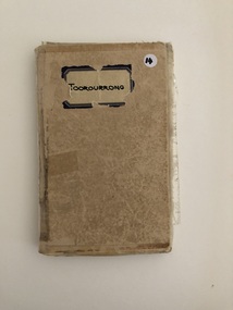
Map, Department of Crown Lands and Survey, Toorourrong, Counties of Bourke and Evelyn, 1936
... Photo - lithographed at the Department of Lands and Survey...Department of Crown Lands and Survey.... Photo - lithographed at the Department of Lands and Survey ...1 map, folding, showing parish boundaries and land ownership. Photo - lithographed at the Department of Lands and Survey, Melbourne by T. F. McGauran. 11.3.36.map, toorourrong, counties of bourke and evelyn, toorourrong parish